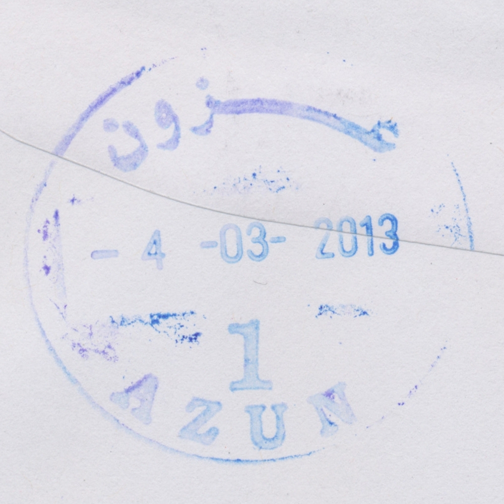
 Azun © OpenStreetMap contributors, CC-BY-SA") | Azun عزون Azzon, Azzun | Pop.: 7,821 Govern.: Qal Opened: 1956 PO Number: 806 Postcode: 350 | |||||||||
| 32°11' N, 35°03' E OpenStreetMap Google Maps Wikipedia | Agricultural village 8 km E of Qalqilya with 7,821 residents (2007 Census, 1997: 5,867), the second largest municipaliry of Qalqilya Governorate. Nearest other PNA offices are Jayyus to the N and Kafr Thulth to the S. Jordanian authorities operated a post office (upgraded from a postal agency on 6.06.1966) from 1956(exact date?) . A post office under control of the Israeli military occupation forces existed from 5.09.1968. The PNA office is next to the Youth Center. | ||||||||||
| |||||||||||
 azun1_130304_0425")
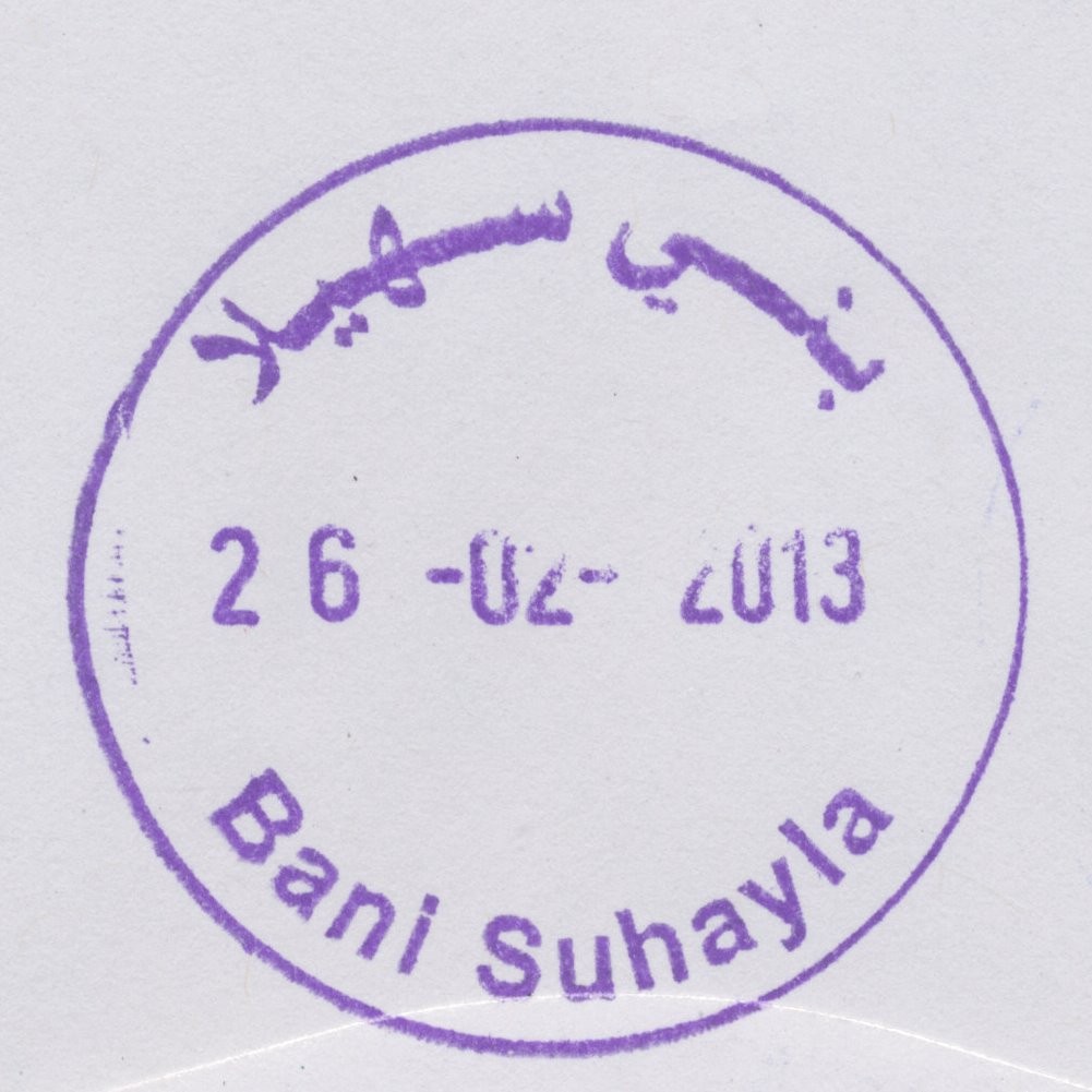
 Bani Suheyla © OpenStreetMap contributors, CC-BY-SA") | Bani Suheyla بني سهيله Bani Sehaela, Bani Suheila, Bani Suhayleh, Bani Suhayla | Pop.: 32,773 Govern.: Kha Opened: 1982 Postcode: 940 | |||||||||
| 31°21' N, 34°20' E OpenStreetMap Google Maps Wikipedia | City about 2 km E of Khan Yunis towards Abssan with a population of 32,773 (2006 estimate, 1997 Census: 23,016). The post office is situated on Al-Awda street near the Hamza mosque. A post office under control of the Israeli military occupation forces existed from 8.02.1968. | ||||||||||
| |||||||||||
 banisuheyla_130226_0421")
 Beit Hanun © OpenStreetMap contributors, CC-BY-SA") | Beit Hanun بيت حانون Beit Hanoun | Pop.: 32,187 Govern.: Gzn Opened: 1995 Postcode: 810 | |||||||||
| 31°32' N, 34°32' E OpenStreetMap Google Maps Wikipedia | City in the East of North Gaza Governorate, 5 km NE of Jabalya. There were 3,876 inhabitants in 1961, 20,780 in the 1997 Census, the 2006 midyear estimate is 32,187. Nearest other PNA post offices are in Jabalya Camp and Beit Lahia. A post office under control of the Israeli military occupation forces existed from 3.06.1973. The office moved to a newbuilt facility on 19.06.2011 (see MTIT) | ||||||||||
| |||||||||||
 beithanun_130206_0423")
 Deir el Balah © OpenStreetMap contributors, CC-BY-SA") | Deir el Balah ديرالبلح Deir El Balah, Dir Elbalah, Deir Al-Balah | Pop.: 49,751 Govern.: Deb Opened: 1948 Postcode: 920 | |||||||||
| 31°25' N, 34°21' E OpenStreetMap Google Maps Wikipedia | Seat of the Governorate with 49,751 inhabitants in 2006 (mid-year estimate) and 42,839 in the 1997 Census. The neighbouring refugee camp has a further 12,004 residents. The post office is situated on al-Shuhadaa street opposite the Cairo-Amman bank. The town's first post office was opened in 1948 under Egyptian rule (TPO postmark). A post office under control of the Israeli military occupation forces existed from 20.07.1967. | ||||||||||
| |||||||||||
 direlbalah1_130310_0420")
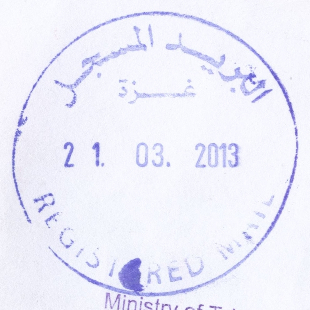
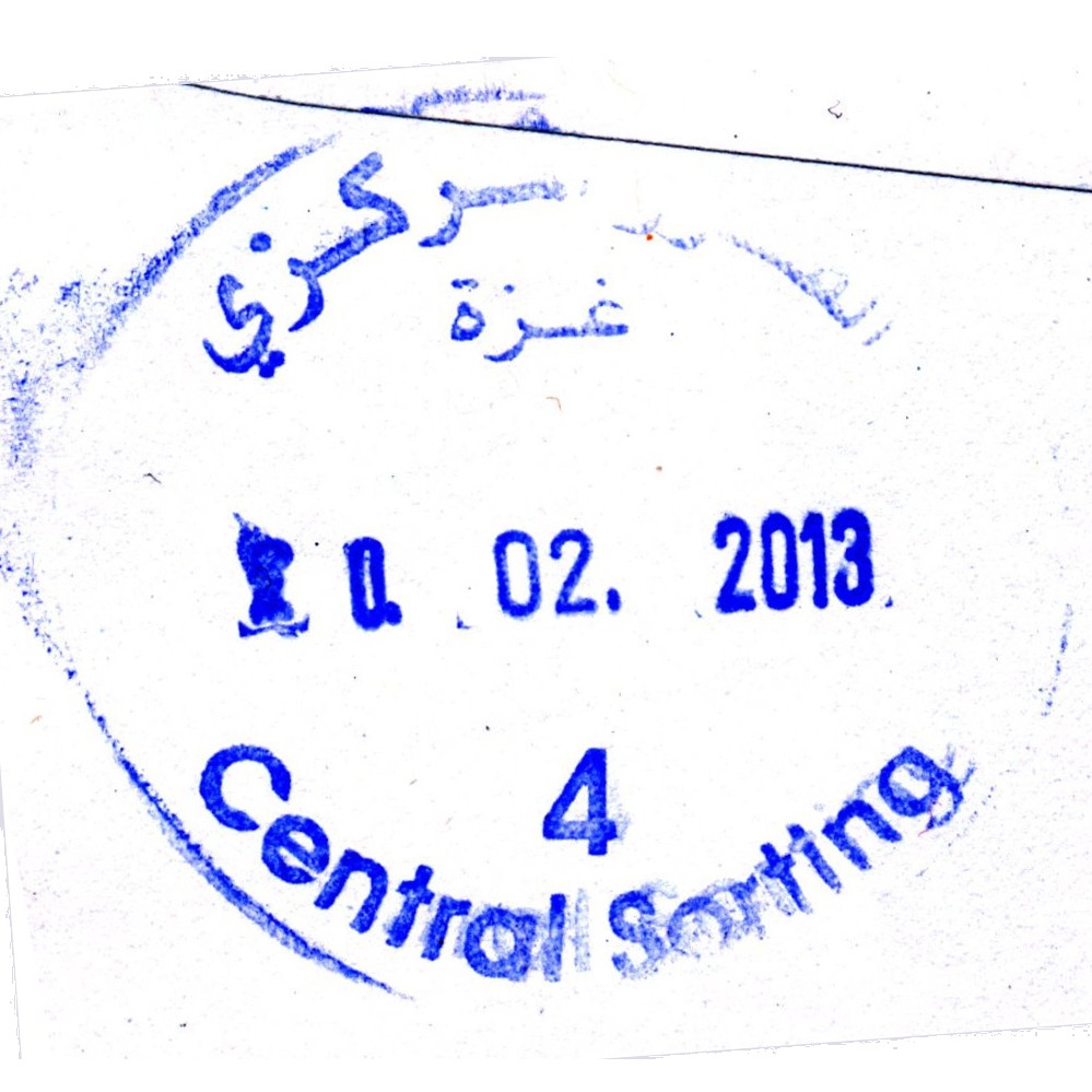
 Gaza, Central Sorting © OpenStreetMap contributors, CC-BY-SA") | Gaza, Central Sorting غزة - الفرزالمركزي Gaza, Central Sorting | Pop.: n/a Govern.: Gaz Opened: - Postcode: 860 | |||||||||
| 31°33' N, 34°27' E OpenStreetMap Google Maps Wikipedia | Central sorting facilty, situated in the Omar al-Mukhtar office. | ||||||||||
| |||||||||||
| |||||||||||
 gazaReg_130321_0419")
 gazacensort4_130220_0424")
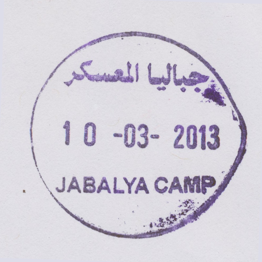
 Jabalya, Jabalya Camp © OpenStreetMap contributors, CC-BY-SA") | Jabalya, Jabalya Camp جباليا المعكر Jabalia Camp, Jabalya Camp | Pop.: 93,455 Govern.: Gzn Opened: 21.02.1999 Postcode: 819 | |||||||||
| 31°32' N, 34°30' E OpenStreetMap Google Maps Wikipedia | Refugee camp, established in 1948, just N of Jabalia city in North Gaza Governorate. Residents in the 2006 mid-year estimate: 93,455, UNWRA estimates about 108,000 refugees in and around the actual camp. ## Egyptian office? 1962 | ||||||||||
| |||||||||||
 jabalyacamp_130310_0422")
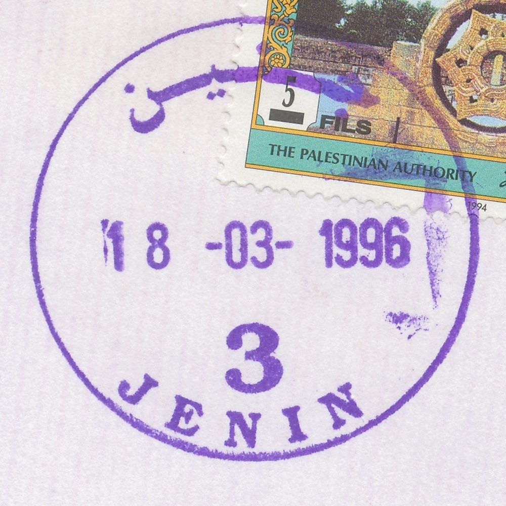
 Jenin © OpenStreetMap contributors, CC-BY-SA") | Jenin جنين Jenin | Pop.: 39,004 Govern.: Jen Opened: 1904 PO Number: 701 Postcode: 200 | |||||||||
| 32°28' N, 35°18' E OpenStreetMap Google Maps Wikipedia | City with adjacent refugee camp (established in 1953), muhfaza, with a population of 49,375 (39,004+10,371) according to the 2007 Census, whereas in 1997 it stood at 35,754 (26,650 + 9,104). The first PO was opened by Ottoman authorities in 1904. Jordanian authorities operated a post office (district main PO) from ### and also a postal agency existed in Jenin Camp from 21.08.1966. A post office under control of the Israeli military occupation forces existed from 17.07.1967. | ||||||||||
| |||||||||||
 jenin3_960318_0426")